News
Satellite Imagery and AI for Urban Resilience 2026 Corridor
Satellite Imagery and AI for Urban Resilience in Canada's Corridor Cities 2026 signals a data-driven push for safer, smarter urban planning.
 Gavin Foss
The Tech Forum reports a growing, data-driven push to harness Satellite Imagery and AI for Urban Resilience in Canada’s Corridor Cities (Toronto, Montreal, Vancouver, Waterloo) 2026. The initiative gathers federal agencies, regional authorities, and private-sector partners to advance open data, interoperable geospatial tools, and AI-enabled analytics designed to improve city resilience against climate hazards, population growth, and aging infrastructure. This year marks a clear inflection point for Toronto, Montreal, Vancouver, and Waterloo as they test cross-city data pipelines, standardized geospatial workflows, and rapid-on-demand mapping capabilities that can be deployed during extreme weather events or sudden urban stressors. The news arrives at a moment when Canadian policy makers and researchers are emphasizing “GeoAI” as a practical bridge between satellite observations and real-time decision making for city planners and first responders. (natural-resources.canada.ca)
In the broader context, Canada has been steadily building a national framework to translate satellite imagery into actionable insights for resilience, hazard planning, and infrastructure management. Government and academic sources highlight a layered approach: open satellite data, AI-enabled processing, and standardized data infrastructures that enable cities of different sizes to participate on a level playing field. The result is a more transparent, repeatable method for detecting urban heat islands, flood risks, and structural vulnerabilities—core inputs for urban resilience strategies in corridor cities and beyond. This convergence of policy, technology, and practice is shaping how Toronto, Montreal, Vancouver, and Waterloo plan for climate pressures, while also supporting private-sector innovation in geospatial analytics. (canada.ca)
Opening
Urban resilience has emerged as a defining capability for Canada’s fast-growing metropolitan corridor. Across Toronto, Montreal, Vancouver, and Waterloo, city leaders are increasingly counting on satellite data and AI to track risk, allocate resources, and validate investments in critical infrastructure. The latest developments show a coordinated push to combine open satellite imagery with machine learning to monitor urban expansion, assess vulnerability, and simulate the impacts of climate-related hazards. In practical terms, this means better flood forecasting, more precise urban heat island mapping, and faster post-disaster assessments that can guide recovery and rebuilding decisions. The news is timely: by 2026, multiple Canadian agencies are rolling out cross-city pilots designed to test scalable, repeatable GeoAI workflows that can be adopted by cities with different geographies, densities, and governance models. This is not a single pilot project; it is a broader, multi-city, multi-stakeholder effort that aims to standardize how satellite imagery and AI contribute to urban resilience across Canada’s most connected metropolitan axis. As with any technology-driven policy push, the key question for residents, businesses, and researchers is: what does this mean for day-to-day decision making, and how quickly can these capabilities translate into safer, more livable cities? The answer depends on data quality, governance, and the ability to integrate climate science with urban planning practice. The work continues, with a clear emphasis on data-driven outcomes and accountability to taxpayers. (natural-resources.canada.ca)
Section 1: What Happened
Announcement Details
- A cross-Canada initiative focusing on Satellite Imagery and AI for Urban Resilience in Canada’s Corridor Cities (Toronto, Montreal, Vancouver, Waterloo) 2026 is entering an active phase, with federal support and municipal collaboration. The project draws on Canada’s existing geospatial strategy—emphasizing open data, GeoAI, and rapid mapping—to accelerate resilience planning in major corridor cities. The emphasis is on building interoperable data pipelines and shared analytics that can be deployed quickly during extreme events or infrastructure stress. While the public communications emphasize the strategic purpose, the underlying content aligns with ongoing government efforts to leverage satellite imagery for hazard monitoring and urban planning. (natural-resources.canada.ca)
Timeline and Key Facts
- Foundational policy threads date back to Canada’s broader satellite Earth observation strategy, which promotes data accessibility and AI-driven analytics as a core capability for resilience, emergency response, and climate adaptation. In 2022, Canada announced a national strategy for satellite Earth observation, signaling a long-term commitment to these capabilities. The 2026 developments reflect that strategy maturing into concrete, city-scale applications in key corridor markets. (canada.ca)
- Government programs emphasize open satellite data and AI-enabled GeoAI Data Series that rapidly extract building footprints, roads, water features, and urban extent from high-resolution imagery. These capabilities underpin planning, risk assessment, and scenario analysis for resilient urban systems. In practice, agencies are moving from data provisioning to decision-support tools that city staff, designers, and responders can use in near real time. (natural-resources.canada.ca)
- Emergency management and rapid-response mapping are at the forefront of this agenda. A Natural Resources Canada (NRCan) initiative highlights on-demand mapping series powered by AI that can be invoked during floods, wildfires, or other disasters to produce timely, contextual risk maps. This capability is directly relevant to corridor-city resilience, where rapid situational awareness can shorten response times and save lives. (natural-resources.canada.ca)
- In parallel, Canadian agencies are exploring the integration of satellite radar (SAR) data with AI-based analysis to monitor floods, urban growth, and infrastructure changes. A growing body of research and government activity points to SAR’s utility in cloudy or obstructed conditions, which are common in northern climate regimes and during extreme weather events. This supports more reliable monitoring when optical imagery is limited. (csa-asc.gc.ca)
Key Players and Partnerships
- Federal agencies (NRCan and the Canadian Space Agency) are central to providing data, infrastructure, and standards that enable city-scale resilience analytics. The collaboration emphasizes a geospatial infrastructure built on open data, AI-enabled processing, and standardized workflows that cities can adopt with less friction. (natural-resources.canada.ca)
- Academic and research partners are contributing to GeoAI methods and urban analytics tools that accelerate the extraction of resilience indicators from imagery. Institutions across Canada are testing methods ranging from building-level detection to neighborhood-scale risk assessments, with Montreal and Vancouver often cited in cross-city AI urban studies. (natural-resources.canada.ca)
- Municipal and regional stakeholders in Toronto, Montreal, Vancouver, and Waterloo are actively engaging with data-analytic pilots to validate use cases and tailor outputs to local governance needs, performance metrics, and public communication requirements. While the exact pilot timelines vary by city, the trend is unmistakable: a move toward standardized GeoAI-driven insights for urban resilience planning. (natural-resources.canada.ca)
What Was Implemented
- The GeoAI Data Series, highlighted in NRCan materials, shows how AI can rapidly derive critical urban features from high-resolution imagery, enabling consistent comparisons across cities and time. The practical upshot is the ability to track urban expansion, road networks, and flood-prone zones with greater speed and reproducibility—a core capability for corridor-city planning. (natural-resources.canada.ca)
- Open data policies and SAR-enabled monitoring are combining to provide resilient, day-to-day visibility into city systems. Civil protection agencies and city planners can rely on radar-based observations to complement optical data, particularly in seasons or conditions where cloud cover reduces optical clarity. This integration is central to urban resilience in dense metropolitan corridors. (csa-asc.gc.ca)
- The emergency-mapping focus remains a critical anchor for the program. By continuously improving on-demand mapping capabilities powered by AI, Canada is aiming to shorten the time from data capture to decision-ready maps, enabling quicker deployments of protective actions during floods or wildfires. (natural-resources.canada.ca)
Section 1 Subsections
What Happened on the Ground
- Cross-city data pipelines: Coordinated data pipelines are being piloted to allow Toronto, Montreal, Vancouver, and Waterloo to share resilience indicators, such as flood exposure, heat vulnerability indices, and critical infrastructure at risk. The emphasis is on repeatable methods that can be scaled to other cities, leveraging Canada’s national geospatial standards and open-data ethos. (natural-resources.canada.ca)
- Tooling and automation: AI-enabled tools for image interpretation, change detection, and hazard mapping are being piloted to reduce manual workloads for city staff while increasing the timeliness and granularity of resilience analytics. Early demonstrations show how AI can identify urban heat islands, temporally map flood extents, and forecast infrastructure stress under various climate scenarios. (changingclimate.ca)
- Data governance and ethics: The corridor-city effort is advancing governance frameworks that balance public access to data with privacy considerations and ethical AI use. While policy details vary by city, the overarching model emphasizes transparent methodologies, auditable analytics, and public accountability in how resilience data inform decisions. (natural-resources.canada.ca)
Section 2: Why It Matters
Impact on Urban Planning and Infrastructure
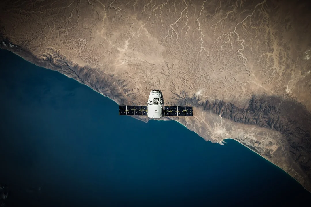
- A core benefit of integrating Satellite Imagery and AI for Urban Resilience is the ability to quantify and monitor risk at a scale that matches the pace of urban change. Smart mapping allows planners to assess where improvements in green infrastructure, drainage, or transit capacity will have the greatest resilience impact, and to simulate the effects of extreme weather on transport corridors and utilities. This aligns with NRCan’s emphasis on open data and GeoAI-enabled decision support. (natural-resources.canada.ca)
- For corridor cities like Toronto, Montreal, Vancouver, and Waterloo, cross-city data comparability enables benchmarking and shared best practices. The GeoAI approach provides consistent indicators across jurisdictions, supporting more coherent regional resilience strategies and attracting private-sector interest in geospatial analytics and infrastructure monitoring. The national infrastructure and spatial-data initiatives are designed to help cities scale the most effective resilience interventions. (natural-resources.canada.ca)
Public Safety, Emergency Response, and Climate Adaptation
- Real-time or near-real-time mapping of flood extents, wildfire perimeters, or heat-stress zones enhances the ability of emergency managers to target resources, communicate with the public, and prioritize evacuations or protective actions. NRCan’s on-demand mapping program illustrates how AI-augmented imagery can produce usable maps quickly when hazards emerge, a capability that is especially valuable in dense urban corridors where risks can cascade through transportation and utility networks. (natural-resources.canada.ca)
- The use of SAR (radar) imagery, which can penetrate clouds and operate in low-visibility conditions, complements optical imagery to provide a more robust, year-round view of city dynamics. In Canada’s climate, this multi-sensor approach improves resilience by ensuring that critical insights remain available during adverse weather that often accompanies climate shocks. (csa-asc.gc.ca)
Economic and Equity Considerations
- A data-driven resilience program can inform infrastructure budgeting by identifying high-risk zones and prioritizing capital investments for climate adaptation. It also holds potential for private-sector collaboration in developing, testing, and deploying GeoAI solutions across the corridor cities. However, the success of such partnerships hinges on transparent governance, open data access, and clear performance metrics. Canadian policy frameworks emphasize these elements to ensure broad public value from the data and tools derived from satellite imagery. (natural-resources.canada.ca)
- Equity considerations are central to the corridor-city work. AI-based resilience analytics must avoid biases in data inputs and ensure that vulnerable communities receive attention in planning and emergency response. Academic and OECD discussions on smart cities underscore the need for AI deployment to align with equity and inclusion goals, which aligns with Canada’s broader climate and urban policy objectives. (oecd.org)
Section 2 Subsections
Impact on Policy and Society
- Standardized resilience indicators: By developing common metrics across the corridor cities, policymakers can compare outcomes, accelerate shared learning, and justify investments in resilient infrastructure. The geospatial infrastructure work described by NRCan is explicitly aimed at enabling informed decision-making through consistent data products. This standardization is a prerequisite for scalable resilience strategies. (natural-resources.canada.ca)
- Public engagement and transparency: The public availability of resilience data—while balanced with privacy protections—supports more informed community dialogue about risk and adaptation options. The ongoing policy emphasis on transparent geospatial data workflows helps communities understand how maps translate into concrete actions, from zoning changes to flood-defense projects. (natural-resources.canada.ca)
Section 3: What’s Next
Upcoming Milestones and Next Steps
- Expanded pilots and deployment: The corridor-city program is expected to move from pilot stages toward broader adoption in 2027, with city staff trained in GeoAI workflows and resilience dashboards that can inform capital planning, zoning, and hazard mitigation. The Canadian federal framework and NRCan-led initiatives provide the scaffolding for this expansion, including data standards and interoperable analytics. While city-by-city timelines vary, the overall trajectory is toward increased operational use of satellite imagery and AI in day-to-day resilience work. (natural-resources.canada.ca)
- Data infrastructure maturation: A key near-term objective is to mature the geospatial data infrastructure so that data layers (land cover, infrastructure inventories, hazard maps) can be integrated with municipal planning tools, 3D city models, and building performance simulations. This aligns with Canada’s broader strategy to modernize geospatial infrastructure and to enable rapid, evidence-based decision-making in urban contexts. (natural-resources.canada.ca)
- Collaboration and standardization: Expect continued cross-city collaboration on standard data formats, API access, and visualization interfaces that support both public-sector users and private-sector partners. The emphasis on open data and GeoAI data series is designed to lower barriers to entry and foster innovation by providing a common, reusable foundation. (natural-resources.canada.ca)
What’s Next Subsections
Roadmaps and Governance
- Roadmaps: Cities in the corridor are likely to publish detailed roadmaps outlining milestones for data ingestion, analytics delivery, and user training. These documents typically cover data stewardship, privacy protections, and performance metrics to assess resilience outcomes over time. The governance framework will be critical to ensuring that analytics remain transparent, reproducible, and accountable to residents. (natural-resources.canada.ca)
- Standards and interoperability: Ongoing alignment with national geospatial standards will be essential to making cross-city comparisons meaningful. As GeoAI workflows mature, they will rely on consistent data schemas for urban features such as buildings, roads, water networks, and flood-prone zones. The standardization work is a collaborative effort across federal and municipal partners, designed to accelerate adoption and reduce duplication of effort. (natural-resources.canada.ca)
Closing
In practical terms, the 2026 corridor-city initiative signals a shift from experimental pilots to integrated resilience workflows that can inform every phase of urban life—from planning and construction to emergency response and post-disaster recovery. The combination of Satellite Imagery and AI for Urban Resilience in Canada’s Corridor Cities (Toronto, Montreal, Vancouver, Waterloo) 2026 embodies a data-centric approach to building better cities, with open data, SAR and optical imagery, and GeoAI analytics at its core. The work is not a single technological inflection point; it is an evolving program grounded in Canada’s commitment to modernizing its geospatial infrastructure, leveraging AI responsibly, and delivering tangible benefits to residents and businesses along the corridor. As these capabilities scale, they will influence how cities allocate resources, manage risk, and engage with communities in the pursuit of safer, more resilient urban environments. (natural-resources.canada.ca)
The Road Ahead for Canada’s Corridor Cities
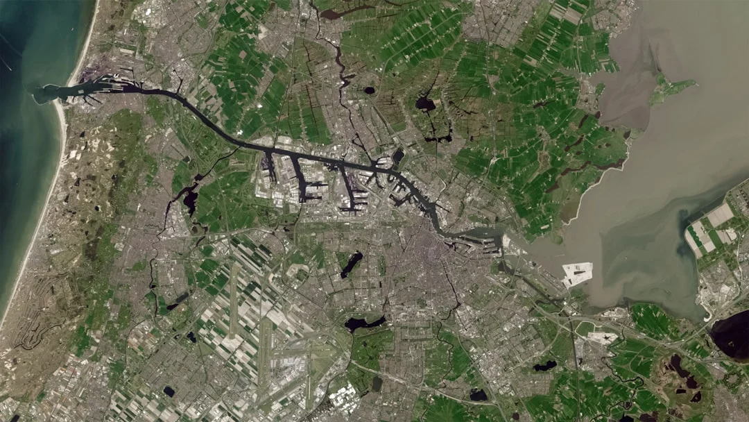
The corridor cities will likely see a sequence of increasingly sophisticated analytics dashboards that merge satellite-derived indicators with locally sourced data (traffic, energy use, susceptibility to heat waves). These dashboards can support proactive planning, such as prioritizing infrastructure upgrades in flood-prone neighborhoods or designing heat-mitigation strategies for high-occupancy zones. The underlying data backbone—built on NRCan and CSA capabilities—gives city teams a scalable path to expand resilience analytics in a way that accommodates both long-term capital planning and crisis response. (natural-resources.canada.ca)
The broader policy context continues to emphasize the value of AI-enabled remote sensing for climate adaptation, disaster resilience, and safe urban growth. International and national studies reinforce that the responsible use of satellite imagery and AI can deliver measurable improvements in hazard detection, recovery times, and planning accuracy. While the specifics of each city’s implementation will differ, the underlying approach—data-informed decisions supported by GeoAI—remains consistent across Canada’s urban landscape. (changingclimate.ca)
For readers tracking technology and market trends, the corridor-city initiative represents a confluence of public investment, scientific advancement, and private-sector opportunity. The next 12–24 months are expected to reveal concrete pilots, expanded data sharing, and new analytics products designed to help city administrators, engineers, and first responders operate more effectively under climate stress. Observers should watch for announcements about data-access policies, open dashboards, and cross-city case studies that illustrate real-world resilience gains. (natural-resources.canada.ca)
Notes on sources and citations
- Canada’s use of AI-enabled, on-demand mapping for emergency preparedness is described by Natural Resources Canada in discussion of on-demand mapping series powered by AI. This illustrates how fast, decision-ready maps can be produced during hazards, a capability that underpins corridor-city resilience efforts. (natural-resources.canada.ca)
- The Collaborative Geospatial Strategy for Canada and the GeoAI Data Series highlight how open data and AI are used to extract building footprints, roads, water, and urban features from imagery, enabling standardized resilience indicators across cities. This infrastructure underpins the cross-city corridor initiative. (natural-resources.canada.ca)
- The Canadian Space Agency’s documentation on SAR data and RADARSAT demonstrates how radar imagery complements optical data, especially under conditions where clouds or heavy weather would limit visible-light observations. This is particularly relevant for climate resilience monitoring in Canadian cities. (csa-asc.gc.ca)
About the author
Gavin Foss
Gavin Foss is the editor-in-chief at Tech Forum, covering the Canadian technology landscape with a focus on AI and emerging technologies. His technical depth and industry connections make him one of Canada's most respected tech journalists.
Keep reading
More from Tech Forum

Anthropic Invests CAD 10M in Canadian AI Research
Anthropic has committed CAD 10 million to support Canadian AI research, establishing partnerships with eight institutions to enhance AI safety, trust,…
Marcus Doyle / September 4, 2026

Sovereign AI Accelerator Launches in Canada
Tech Forum analyzes the Sovereign AI Accelerator rollout, its goals, and market implications in a data-driven, neutral report.
Claire Bergeron / September 3, 2026

Lastwall Raises $16M to Boost Canadian Cyber Defense
Lastwall has secured a $16 million investment to enhance Canada’s cyber resilience, following its success in the U.S. federal market and FedRAMP…
Steph Moreau / September 2, 2026